|
Guadalupe Mountains National Park (GMNP)in far west Texas is a landscape photographers dream. That might seem debatable to those who drive the interstate across the Permian Basin but if you can make it to the Guadalupes, you will find mountains, desert, sand dunes, salt flats, grasslands, canyons, alpine forest, and believe it or not, maples. This truly spectacular place is a hidden gem of a National Park for the camper, hiker, and photographer. Conditions are often challenging but if you can persevere, you will find this to be an amazing place with limitless photographic possibilities.
It's Remote!
First of all, this park is very remote. It is 110 miles from El Paso and 50 miles to Carlsbad, New Mexico. It is 40 miles to the nearest gas station or motel (at the neighboring Carlsbad Caverns NP) and over 50 miles to a supermarket. This is not the typical park experience. Instead, it’s a location you better come prepared for and expect challenges.
Camping
The main part of GMNP is at Pine Springs Canyon (elevation 5700‘), where the visitor center and a small campground are located. The campground has 20 walk-in tent sites and a separate parking lot for RVs (about 15 spaces). It has a few scattered water spigots, a restroom, and a service sink to wash your dishes. There are no electrical hookups of any kind. Fires (even charcoal) are not allowed in GMNP but camp stoves are permitted. On a holiday or a weekend during fall foliage season, all of the sites will be filled late in the afternoon yet at least half will be available by noon of the next day.
I would suggest setting up a base camp at Pine Springs and then to make day trips/hikes for photography. If camping is not for you, stay in Carlsbad and drive the 50 miles to the park for the day.
Wind
The biggest camping/photography challenge is the wind. Steady 30-40 mph winds are a common occurrence here and 75+ mph winds are always a possibility. This is not the place to have a department store tent. I have seen many cheap tents torn, destroyed, or just blown away, so plan accordingly. Even cooking can be a challenge, as the wind has been known to send stoves tumbling. Wind can also impact your photography, especially if you are a large format photographer (I know from experience). Bring a good tripod and be prepared to weigh it down, if possible.
Photography
The photography at GMNP is truly outstanding. Very few places can match the variety of terrain that exists in this one place. You can photograph sheer cliffs and high grasslands at dawn, hike into lush maple filled canyons for lunch, and spend sunset on sand dunes.
A good game plan is to photograph the eastern side of the mountains in the morning (several areas within a 5 minute drive); hike into one of the canyons or the high country during the day; and look at some of the areas to the south or western side of the mountains for a sunset (a 15-45 minute drive).
The Mountains
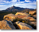
The mountains themselves are oriented on a north-south axis and get great light at both sunrise and sunset. The Guadalupes end dramatically at a sheer 1500' cliff called El Capitan. The cliff is “V” shaped and when seen from above, looks like the prow of a ship and is visible for many miles. It’s a subject you could undoubtedly photograph over several days.
There are several spots west of camp on US 62-180 that are great morning photographic locations. Traveling farther west, you will get to good evening locations. The famous boulder field (on private property but can be seen and photographed from the road) is a half-mile west of the Hwy 54 split and the salt flats are about 10 miles beyond that (See map link below).
The Canyons
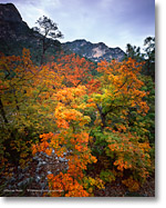
The eastern side of the Guadalupes has two major canyons: Pine Springs and McKittrick. Each is spectacular and both have maple trees. They are worthy of a visit anytime of the year but especially in late October when the maples reach peak color.
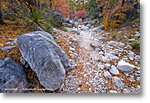
Pine Springs Canyon is dry and the rugged trail leaves the campground and follows the rocky streambed around boulders deeper in the mountains to Devils Hallway, which is a sheer narrows.
McKittrick Canyon is a deeper canyon with year round water and has been called “The prettiest spot in Texas.” It has the most maples in the Park and is heavily visited (by this Park’s standards) in the fall for the spectacular color display that happens here. Note that McKittrick Canyon is a day use only area, so it is best photographed on overcast days. The trail there is mostly flat gravel and I suggest going all the way to the Grotto and allowing 5-6 hours to take in the sights.
The High Country
The mountain high country reaches to almost 8900 feet in elevation and offers an alpine environment that is reminiscent of southern Colorado. Guadalupe Peak is the highest point in Texas. There is a backpacker’s camp below the summit that gives 270-degree views across El Capitan and the deserts below. The area known as “The Bowl” is north of Pine Springs Canyon and it’s filled with Ponderosa Pine and aspen - a relic ice age forest.
Several trails and campsites are worthy destinations here for those with the stamina to make it up the 2000' canyon wall. Note that there is zero water in the high country (no streams, ponds, or springs at all) so you will need to pack in all water.
Off The Beaten Path
GMNP has a couple of areas off the beaten path that it takes some extra effort to reach and are very rewarding: Williams Ranch and the Salt Basin Dunes. Few people know of these areas and they are not really published for the general public. For those who know about them, however, they are a great destination for photography.
To visit either location, you first have to check out the respective gate key from the rangers at Park headquarters. They will give you a map, directions, and the key. Note that both Williams Ranch and the Salt Basin Dunes are day use only areas so no camping is allowed at either site.
Williams Ranch is a rugged high clearance road requiring 4WD into a remote old ranch house under the western cliffs of the escarpment.
The Salt Basin Dunes require a 45-mile, one-way drive to pure white gypsum sand dunes (just like at White Sands, New Mexico). The dirt and clay road to the dunes is passable by cars if dry. If it is wet, then all bets are off even for 4x4's. From the parking area, it is a 1.5-mile hike into the dunes. Stay on the trail or the sand. Also, be sure to bring a headlamp, as you will be walking out in the dark.
Finally, if the wind, rain, or temperatures are too hot for you, drive up to Carlsbad Caverns and walk through the caves. It is always a cool 56 degrees in there.
Map of the Park: http://www.nps.gov/gumo/planyourvisit/upload/parkmap1.pdf
For more information: http://www.nps.gov/gumo
Comments on NPN nature photography articles? Send them to the editor.
Darren Huski is a landscape photographer from Fort Worth, Texas. He photographs the Lone Star State and throughout the American west and midwest. His work can be seen at www.WildernessPhotographer.net. Darren also blogs about his travels with a large format camera which can be followed at http://thetravelingcamera.blogspot.com.


