Elements of Storm
by Christian Klepp
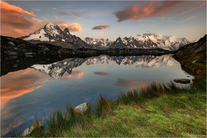
The rainy and chilly central European summer of 2011 was caused by a stationary through situation. The upper air stream of the mid latitudes usually moves slowly from west to east by meandering around the globe. This year a blocking situation stopped the movement and the trough was situated just over Europe. Numerous low pressure systems developed within the associated cold and cloudy air of polar origin. The southern border of the trough was most often located in the area of the Southern Alps causing frequently changing weather of moving fronts and weak high pressure ridges. Often orographic foehn clouds appeared in connection with high wind speeds over the mountains as precursors for rainy weather. Cold fronts caused thunderstorms with intense convective rainfall and fresh snow on the high peaks. Such instable weather produces dramatic cloud decks but also high wind speeds that destroy lake reflections. Additionally the moisture causes the 15780 ft (4810 m) high Mt. Blanc massif to hide in convective clouds for most of the time. Some time and effort is needed to photograph the snowy massif at low light conditions including a perfect reflection in the lake.
August2011
Canon 5D MkII, Canon L 16-35 mm, f/16, 4 sec, ISO 100, Lee GND, tripod

Comments
15 commentsthe angle you have chosen is excellent
for my taste, I feel the grass in the FG is a s little bit light
Cheers
Christian.
Jose
Just change the 'instable' to 'unstable' and the first t(h)rough and you're good to go!
Seriously, a real nice shot, magnificent mountain range with some good conditions. Darken the immediate fg a bit and this will be a real winner!
Add me to the "darken the foreground camp", but other than that, I love it!
Nick Bristol
Lone Rock, WI